Magnificent dated 1892 terrestrial Student Globe exceptionally well preserved


Magnificent dated 1892 terrestrial Student Globe exceptionally well preserved
$975.00
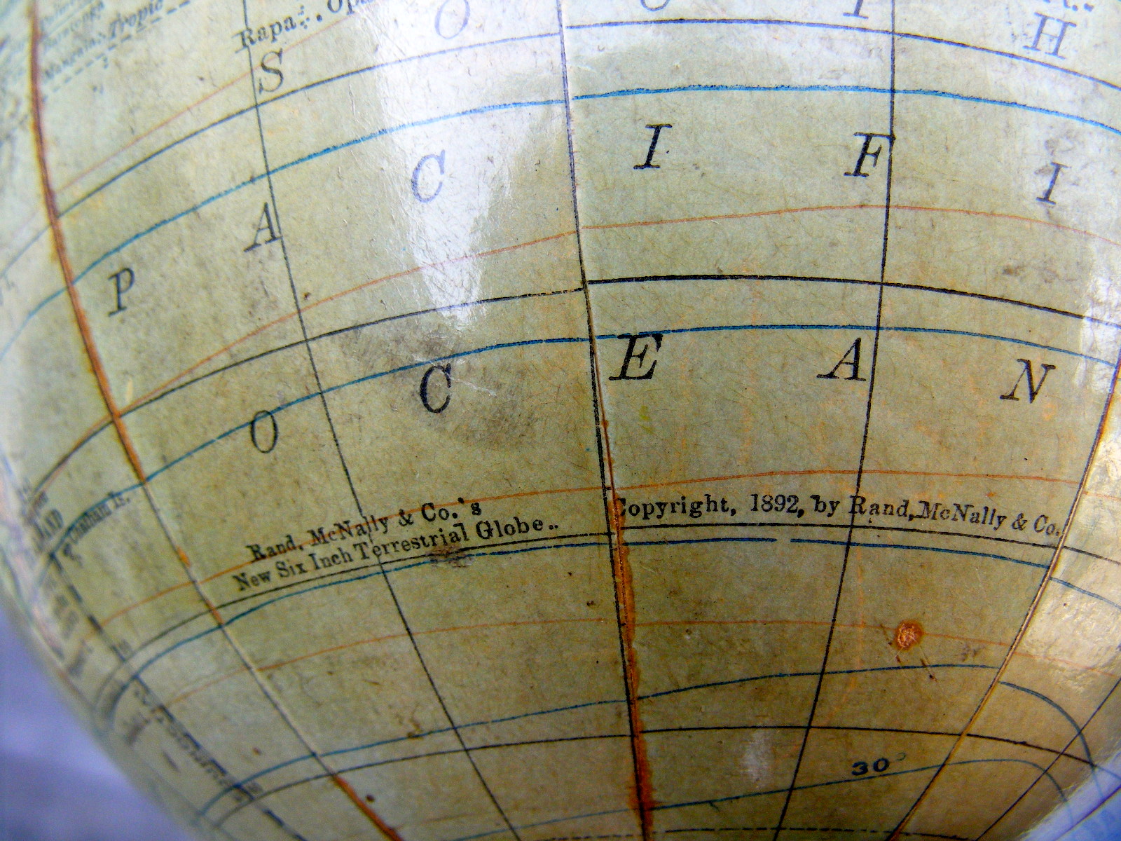
1892 dated Rand McNally terrestrial Student Globe
This fine artifact, titled “The American Globe” was produced by Rand McNally of Chicago ( see print date and manufacture on map) and sold through J.P. Lippincott Company of Philadelphia, a well established school supply business during the late 1800’s.
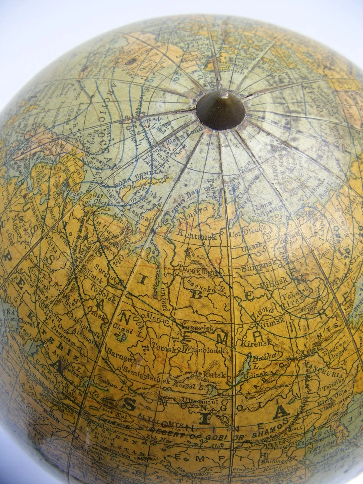
This Globe offers excellent visual history by displaying Empires and metropolitan centers of the past.: Austro-Hungarian and Ottoman Empire, Constantinople, Christiana , St. Petersburg and a young United States with Indian Territory are identified, just to name a few. Territorial claims of Imperial powers are documented, showing European Colonies in Africa and throughout the world.
Lost empires, colonies and countries can be viewed, from the State of East Africa to the German Pacific territory owned Papua.
Land to be discovered still remains as explorers have yet mapped or conquered Antarctica. No one has even outlined the borders of this continent.
The exceptionally detailed display on this artifact reminds one of the long lost art of globe and map making. Ever so delicately engraved and copper plate printed details describe political borders, cities, countries, territories, rivers and more. A craft that no longer exist in the modern world of digital print.
Each of the 12 paper gore was skillfully applied to a petite orb with the result of an exceptionally artifact, petite is size but grand in history.
Description:
The globe itself is made of plaster, covered with 12 individual, hand mounted paper gores. The globe is mounted dowels style and connects to a tri-legged base. The entire mount is made of solid metal. An attractive statement, no doubt! The globe itself has a 6” diameter with a total height of about 11.5” inches.
Condition:
The globe itself is exceptionally well preserved for its age. Less (by far!) than expected wear in form of scuffing and soiling. Details are crisp, colors warm, offering a perfect patina. The mount is in good condition, no cracks but some minor pitting and corrosion condition. Please see pictures in detail.
The age of the Globe has been determined by the political borders displayed, which are as follows as well as the copyright date on the map shown as 1892:
Europe:
The Austro Hungarian, Ottoman, Russian and German Empire are identified as well as the Metropolitan cities of Christiana, Constantinople, St Petersburg and more.
Middle East-Asia:
The extent of the Ottoman Empire is evident. The Arabian Peninsula is identified as such, no Saudi Arabia, Iran, Iraq.
Africa:
German Colonies are shown (lost at the treaty of Versailles post WW1), Congo Free State is identified (became Belgian Congo in 1908). Egypt has yet to establish its borders and what is later Libya is identified as Tripoli instead. Orange Free State is visible. Rhodesia has not yet replaced Ndebele territory of Zimbabwe. Abyssinia is not yet established (1896).
Well packed, this artifact will ship domestic for $18.00, $42 World Wide
$975 - Item #: FZ1013RMCN92 - SOLD
sold out